

WEEKEND BACKPACKING TRIP
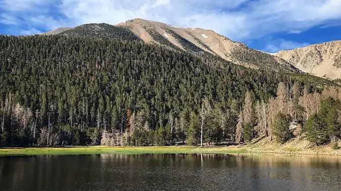
San Gorgonio Mountain is the tallest peak in Southern California (11,502 feet) We will be taking the South Fork Trail to Dry Lake. We will be camping near Dry Lake. Depending on weather conditions, we might need mircro spikes or crampons. Possibly snow at higher elevation. So San Gorgonio Peak will be optional.
Miles: 22 +/-miles
Days: 2 days, 1 nights
Elevation Gain/Loss: 4600’
Type of Trip: Backpacking
Difficulty: Moderate/Strenuous
Location: San Gorgonio Wilderness
The South Fork Trailhead is on Jenks Lake Road, 2.5 miles from Highway 38. The trail begins at the large paved parking lot on Jenks Lake Road.
NO PLUS (1)
MAP: SAN GORGONIO MAP
**Please be prepared and know all of the required gear you’ll need for this backpacking trip. If you have any questions, please post them on the thread or email me directly via Meetup.
DISCLAIMER:
Hike at your own risk. Be responsible for yourself and your safety. Make good decisions. With any trip, things can change, reservations can get lost, the unexpected can happen. A go-with-the-flow attitude is always a good thing, and most importantly, let’s all have fun! This is an intermediate hike. Make sure you are in good enough physical shape for the distance, elevation changes, and terrain. The hike leaders in this group aren’t professional hike leaders. By signing up for these events, you agree not to hold the Meetup organizers responsible for whatever happens to you on these events. The hiking group does not certify the expertise of the organizers, the event or assistant organizers (hike leaders) and…We are NOT responsible for any possible losses or injuries.
We reserve the right to deny or remove any members if they are deemed inappropriate for this trip.


")


