Site Search

Hike to Josephine Peak – San Gabriel Mountains

Loading Hikes
  • This hike has passed.

Hike to Josephine Peak – San Gabriel Mountains

Let’s do another awesome peak in the Angeles National Forest!

This hike will be to Josephine Peak. It is an out and back hike that will be about 8 miles and 1,850 ft. of elevation gain. The peak has an elevation of 5,558 ft.

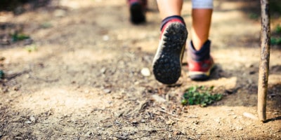
It will be an easy hike to navigate. We take one trail all of the way to the top. There is not a lot of shade, so sunscreen, hat, and shades are recommended! Along with water, snacks, maybe poles if you like them, good boots…

Link to Google Maps: Clear Creek Information Center Angeles Crest Hwy La Cañada Flintridge, CA 91011 https://www.google.com/maps/place/Clear+Creek+Information+Center,+Angeles+Crest+Hwy,+La+Ca%C3%B1ada+Flintridge,+CA+91011/@34.2694629,-118.153166,20z/data=!4m6!1m3!3m2!1s0x80c2e8d7457d6769:0xb911d0074ddf83c2!2sJosephine+Peak,+California+93550!3m1!1s0x80c2e8e6accd87b1:0x108062b9b29aa263

The parking lot is directly across the street from the Clear Creek Information Center. This is right where the Angeles Crest Highway meets the Angeles Forest Highway.

Dogs are allowed on this trail.

For parking, this hike requires an Adventure Pass. You can purchase a day pass for $5 or an annual pass for $30. Here is a link to where you can purchase either the day/annual pass. (Please purchase beforehand, as you cannot purchase it in the parking lot.) http://www.fs.usda.gov/detailfull/r5/passes-permits/recreation/?cid=stelprdb5181410&width=full

Please ask any questions you may have; I’ll do my best to answer them.

May 13 2023

Details

Date: May 13, 2023
Time: 8:00 am - 12:00 pm
Hiking Group:
RSVP: Visit Meetup Website

Venue

Clear Creek Visitor Information Center

Angeles Crest Hwy
La Cañada Flintridge,CA91011US

+ Google Map

Organizer

Trail Mix
Email:
Website: Visit Organizer Website

Comments

Leave a comment

Trail statistics are approximate. For safety purposes always assume they are underestimated. But don’t be disappointed if they are overestimated. Bring more water and snacks than you think you’ll need.

Trail descriptions are based on previous hikes. Current conditions are unknown until arrival. Expect the unexpected and plan accordingly.

The Organizers and members of Hiking With Dean are not professional leaders, guides, or mountaineers. The function of the member or organizer is only to organize the trip. Each person who shows up for a trip/meetup (and their guest or guests) is responsible for his or her own safety. By attending a hike, or any other event organized by this group, you are acknowledging that you and any guests that you bring are aware of the risks, dangers and hazards associated with the activity and freely accept and fully assume all such risks, dangers and hazards, and further agree to release and discharge the Organizers, Members of the Hiking With Dean Meetup Group from and against any and all liability arising from your participation in the group activities per our ASSUMPTION OF RISK AND LIABILITY WAIVER and Section 6.2 of the Meetup.com Terms of Service.